")


GUA MUSANG, Jan 11 ― Asod Busu, 57, has lived near Kuala Betis all his life. He recalled a time when the waters of the Nenggiri River system here were clear and fishes, abundant. According to him, it has not been so since the late 1990s.
Standing by the bed of the Betis River that ran through Kg Parik, where Asod now lives, the water is brown. He said, however, that it has been this way even before the recent heavy floods struck.
Worse than the muddy hue, however, is the current scene of devastation.
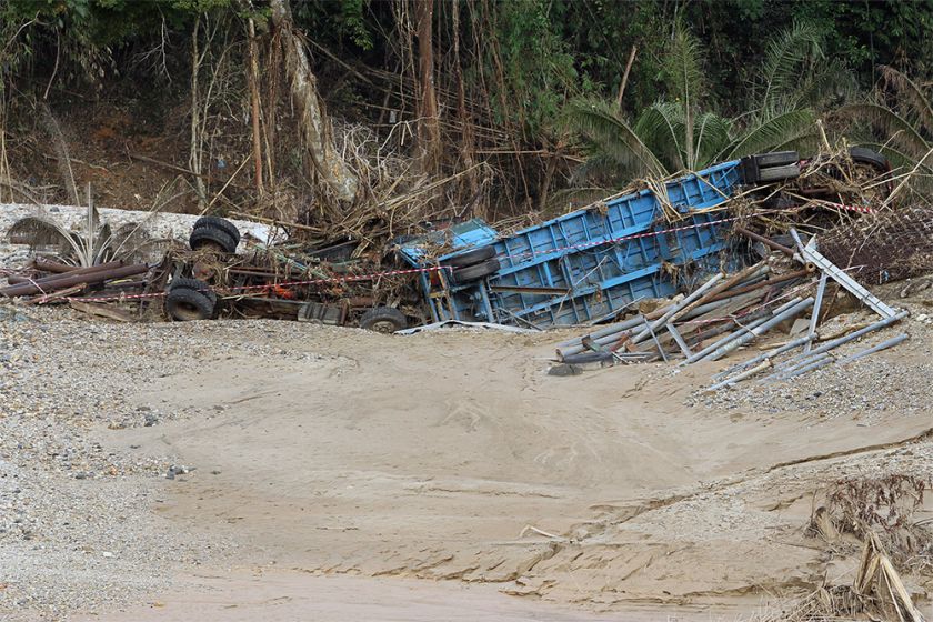
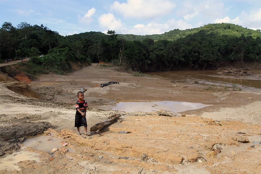
Debris littered the river bed, refuse carried over from two houses that were submerged and destroyed by the deluge. Buried half in the sand was a black four-wheel drive vehicle, its glass windows long gone.
On a bank in the middle of the river, heavy tree trunks found their resting place after currents carried them downstream from logging areas.
Just across, a lorry and its trailer bed laid upside down, mingled with steel pipes that might have been its load.
Before the floods, the site was a sand mine where up to four different companies had operated since 1998, increasing its size gradually from one riverbank to the other.
Despite the state government's claim otherwise, Asod was convinced that the massive deforestation upstream, combined with this mine, were the reasons why Kg Parik and other low-lying outposts were flooded this year.
“The current carried a log straight to my house. I was lucky it did not collide with my house,” Asod recounted when Malay Mail Online visited the village during a flood relief mission.
“Upstream of this river, the lands are now barren. And when the waters came, we're the ones affected.”
“Others would take away our sand, and they would be able to live rich. Meanwhile, we would have to depend on handouts from the government. Without it, we might have already been wiped out,” said a 78-year-old Temiar called Geryon, who lived in Kg Tapai near Pos Balar.
Earlier this month, Kelantan Mentri Besar Datuk Ahmad Yaakob denied that Kelantan's worst floods in recent history was the result of illegal logging, especially in timber-rich Gua Musang, insisting that the state has abided by its annual quota.
Just yesterday, Datuk Dr Mohd Khairuddin Aman Razali of PAS' Ulama Wing warned others against blaming and slandering Kelantan for the floods, labelling those who do so as “celupar”, or foul-mouthed.
A rough aerial survey the area, however, showed that deforestation in Gua Musang, whether illegal or not, could have played a major role in the floods that saw over 250,000 people in several states displaced.
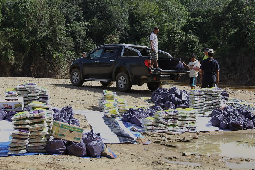
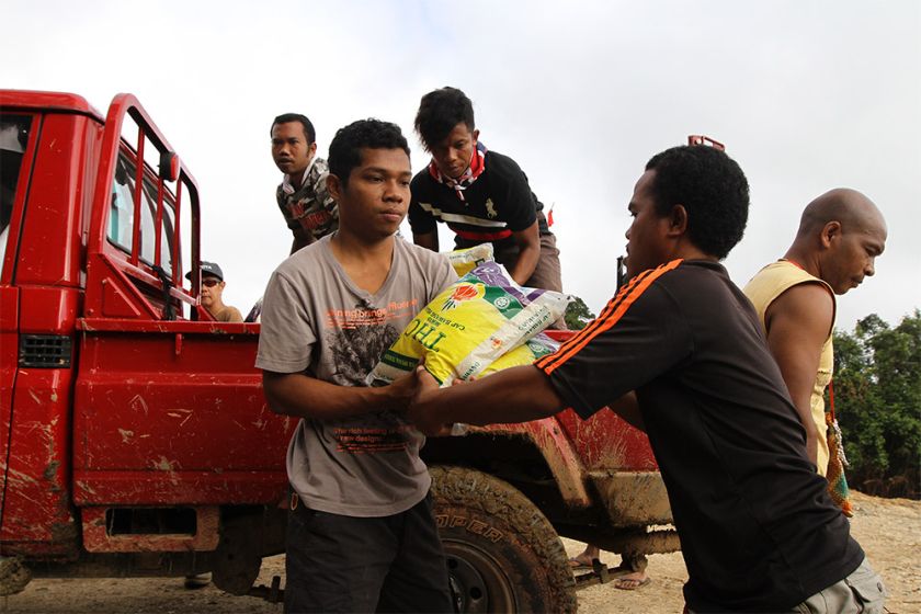
Malay Mail Online joined a couple of helicopter trips to deliver flood relief aid to several Temiar outposts in the area, which has been cut off from the outside world for days after the dirt roads and bridges that connect them were destroyed by the waters.
On the way to the outposts, southwards from Kuala Betis parallel to the Second East-West Highway connecting Gua Musang to Cameron Highlands through Lojing, there were numerous oil palm plantations and logging operations spread across, in between the limestone hills.
Every so often, landslides could be spotted, cutting downhill across the logging trails that spiralled around the mounds, their red earth sometimes joining the murky rivers. One trip revealed an ore mine that has left one side of a hill totally bare.
“They have shoved our lands flat. They have even shoved the graveyards of the Orang Asli,” Itam Anjang said of vegetable plantations between Gua Musang and Lojing.
“When heavy rain comes, of course the waters would move down here ... Before this, we were not even affected,” said the 50-year-old who lived in Kg Kuala Tahu near Pos Brooke here.
The vegetable plantations spelt another threat for Itam, who was beaten up in February last year by Myanmar workers of the plantations when he crossed through the plantations to get to his brother's house.
Itam received seven stitches, and one of his friends needed 15. Another friend, Anis, had his motorbike crushed by a tractor. Their case is due to be heard in court this year.
Now facing twin threats ― plantations that were increasingly encroaching on their lands, and the possibility of another disastrous floods ― the people of Kg Kuala Tahu could only turn to the Village Network of Kelantan Orang Asli (JKOAK) to hear their plea.
According to them, one Singaporean-owned farm has been illegally clearing out 3,000 hectares of land between 2005 and 2013, and had brought in thousands of illegal Myanmar workers.
“This 'coffee' is thanks to Lojing,” Itam said, referring to the colour of Betis River. “You don't even have to bring your own milk.”
In December, Prime Minister Datuk Seri Najib Razak had alluded to widespread land clearing as one of the factor behind the worse floods this year after a visit to Gua Musang.
Kelantan had insisted that exceptionally heavy rain was the main cause behind the floods, and blamed “irresponsible parties” for any illegal land clearing instead.


