SEPTEMBER 3 — In the Pulau Batu Puteh case, both Malaysia and Singapore referred the International Court of Justice (ICJ) to nearly 100 maps. Both, however, agreed that none of the maps established title in the way, for instance, that a map attached to a boundary delimitation agreement might.
They did contend though that some of the maps issued by them or their predecessors had a role as indicating their views about sovereignty or as confirming their claims.
Malaysia emphasised that of all the maps before the Court, only one published by the Singapore government included Pulau Batu Puteh as within its territory and that map was not published until 1995.
Malaysia also referred to three maps published in 1926 and 1932 by the Surveyor-General of the Federation of Malay States and Straits Settlements which might indicate that the island was within Johor.
The Court, unfortunately, was inclined to doubt the significance of those maps. In any case if there was significance, it was outweighed by the more recent maps published by Malaya and Malaysia which were relied on by Singapore.
There were six maps, published by the Malayan and Malaysian Surveyor General and Director of National Mapping in 1962 (two maps), 1965, 1970, 1974 and 1975. Those maps included Pedra Branca/Pulau Batu Puteh with four lines of information under it:
“Lighthouse 28, P. Batu Puteh, (Horsburgh), (SINGAPORE) or (SINGAPURA).”
Exactly the same designation “(SINGAPORE)” or “(SINGAPURA)” appeared on the maps under the name of another island which unquestionably was under Singapore’s sovereignty.
This was compared to a map in the same series of maps where the site of another lighthouse administered by Singapore.
There was no similar annotation — an omission indicating that its inclusion had nothing to do with ownership or management of the lighthouse.
Singapore argued that the six maps were significant admissions against interest by Malaysia. Malaysia responded by arguing that:
(1) the annotating might be assessed differently;
(2) maps did not create title;
(3) maps could never amount to admissions except when incorporated in treaties or used in inter-State negotiations; and
(4) the maps in issue contained a disclaimer.
On Malaysia’s first contention, it appeared to the Court that the annotations were clear and supported Singapore’s position.
On the second point, the Court saw strength in Singapore’s more limited argument that the maps gave a good indication of Malaysia’s official position rather than being creative of title.
On the third, there was authority for the proposition that admissions might appear in other circumstances (e.g. Frontier Dispute (Benin/Niger), I.C.J. Report 2005, p. 119, para. 44).
On the fourth the Court referred to the Boundary Commission in the Eritrea/Ethiopia case where the Court had said:
“The map still stands as a statement of geographical fact, especially when the State adversely affected has itself produced and disseminated it, even against its own interest.” (Decision regarding Delimitation of the Border between the State of Eritrea and the Federal Democratic Republic of Ethiopia, 13 April 2002, p. 28, para. 3.28.)
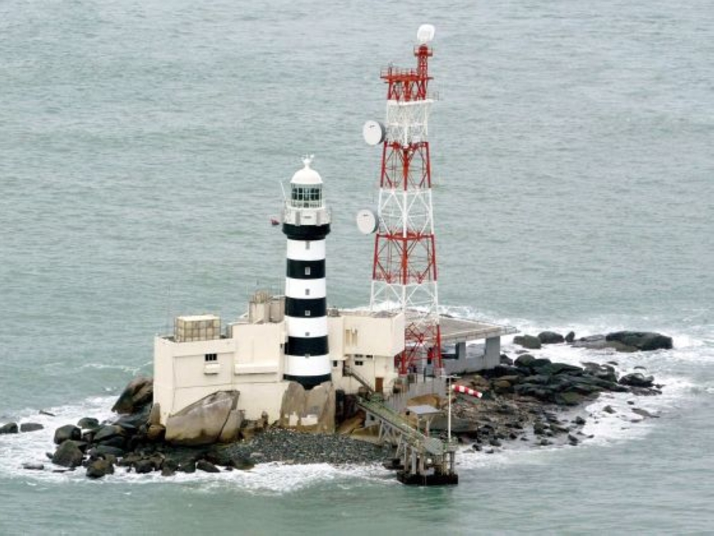
Although Singapore did not, until 1995, publish any map including Pulau Batu Puteh within its territory, that failure to act was in the view of the Court of much less weight than the weight to be accorded to the maps published by Malaya and Malaysia between 1962 and 1975.
The Court concluded that those maps tend to confirm that Malaysia considered that Pulau Batu Puteh fell under the sovereignty of Singapore.
However, there was more to just the maps tilting the decision in favour of Singapore.
The ICJ decision was based on the principles and rules of international law and of the assessment the court had undertaken of the relevant facts, particularly the conduct of the parties, that sovereignty over Pulau Batu Puteh belonged to, or rather passed to, Singapore.
The conduct included Singapore being the operator of lighthouse on the island, the island republic’s investigation of marine accidents, control over visits of the island, installation of naval communication equipment and its reclamation plans — all of which concerned à titre de souverain, which implies, on the one hand, the effective exercise of the attributes of sovereignty (corpus), and, on the other hand, sovereign intent (animus).
According to the ICJ, Malaysia did not respond in any way to that conduct, of all of which (but for the installation of the naval communication equipment) it had notice.
The ICJ further considered that the Johore authorities and their successors took no action at all on Pulau Batu Puteh from June 1850 for the whole of the following century or more. And, when official visits (in the 1970s for instance) were made, they were subject to express Singapore permission.
In addition, Malaysia’s official maps of the 1960s and 1970s indicated an appreciation by it that Singapore had sovereignty. Those maps, like the conduct of both parties, were fully consistent with Singapore having sovereignty over the island.
In its judgment, the Court said:
“The relevant facts, including the conduct of the Parties... reflect a convergent evolution of the positions of the Parties regarding title to Pulau Batu Puteh. The Court concludes, especially by reference to the conduct of Singapore and its predecessors à titre de souverain, taken together with the conduct of Malaysia and its predecessors including their failure to respond to the conduct of Singapore and its predecessors, that by 1980 sovereignty over Pulau Batu Puteh had passed to Singapore.”
So, here’s a lesson from the above.
Malaysia must not fail to respond to conduct of any state that affects its sovereignty and territorial integrity, like China’s power play over islands and reefs in the South China Sea as well as adjacent waters.
*This is the personal opinion of the writer or publication and does not necessarily represent the views of Malay Mail.


